Earthquake information
- Epicenter
- Epicenter
- Seismic intensity
-
- 1
- 2
- 3
- 4
- 5-
- 5+
- 6-
- 6+
- 7
- Epicenter
- Epicenter
- Seismic intensity
-
- 1
- 2
- 3
- 4
- 5-
- 5+
- 6-
- 6+
- 7
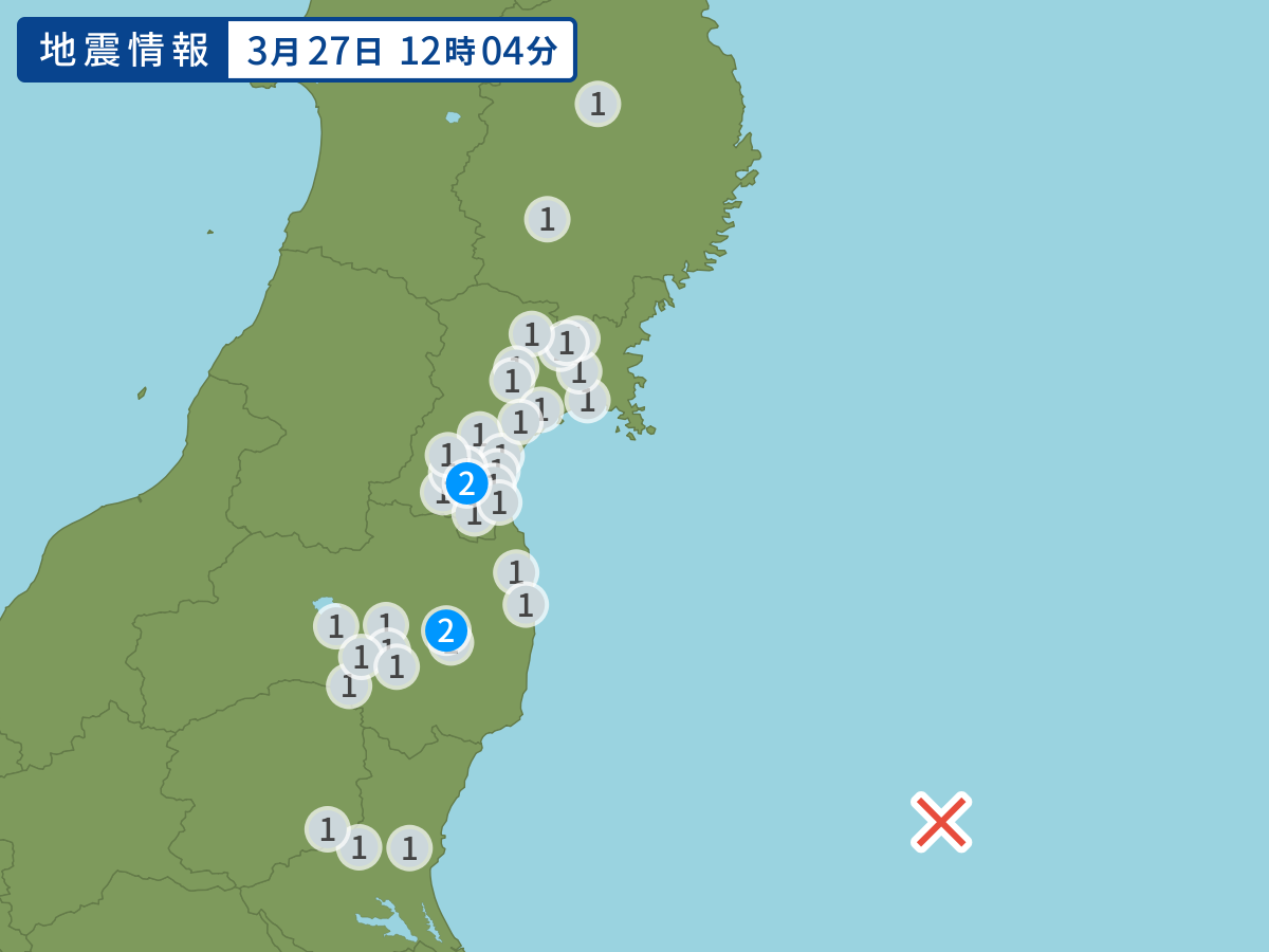
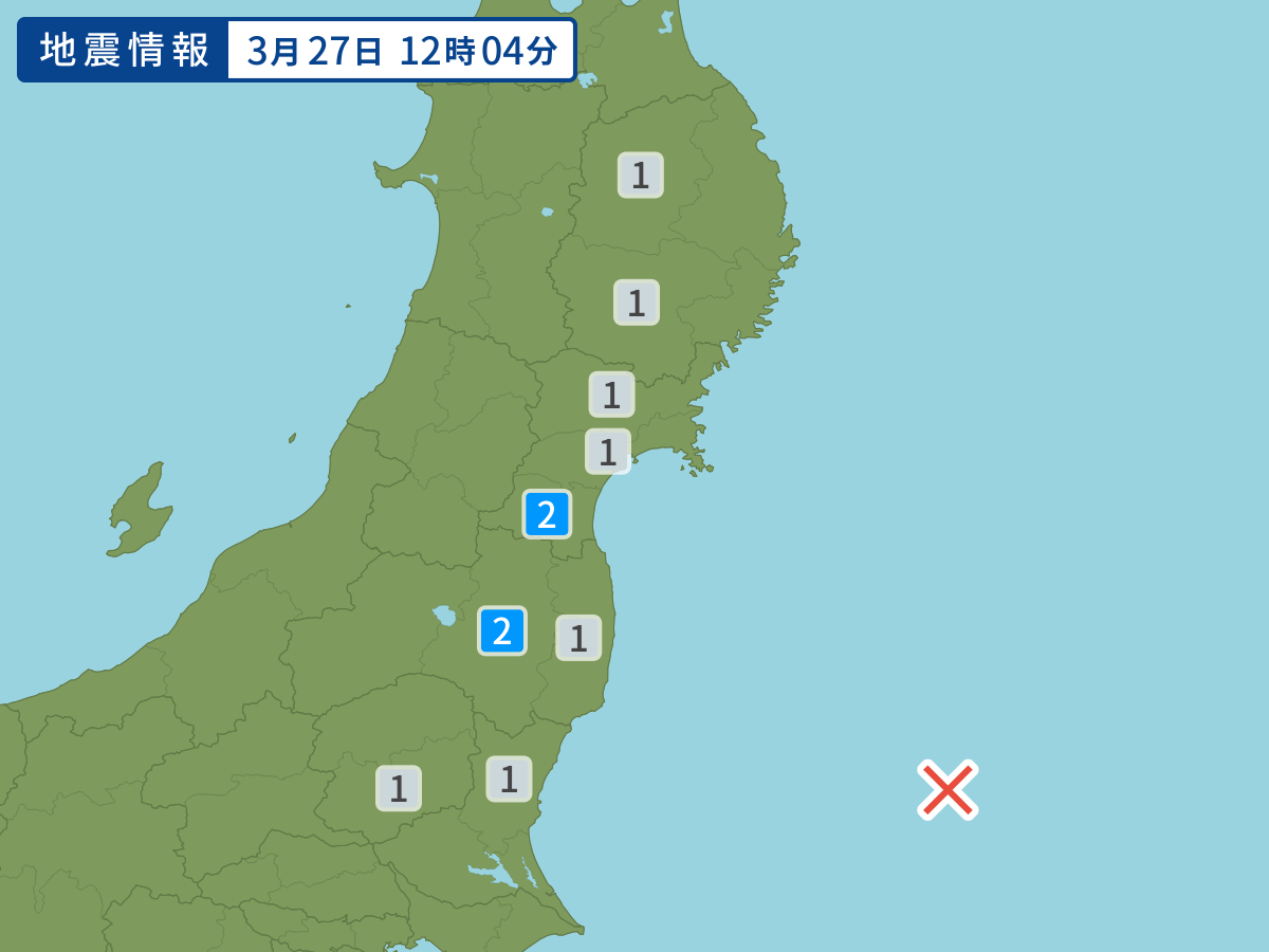
Occurred at 03/27/2015 12:04 JST
This earthquake poses no tsunami risk.
-
- Occurred at
- 03/27/2015 12:04
-
- Epicenter region
- Off the east Coast of Kanto
-
- Maximum seismic intensity
- 2
-
- Magnitude
- 5.2
-
- Depth
- 10km
-
- Latitude/Longitude
- 36.5N142.9E
Seismic intensity in each area
Seismic intensity/Region where observed
| 2 |
|
|---|---|
| 1 |
|
03/27 12:09
Issued by the Japan Meteorological Agency (JMA)
Earthquake history
-
- Occurred at
- 04/25/2024 23:54
- Epicenter region
- Off the Coast of Iwate Prefecture
- Maximum seismic intensity
- 1
- Magnitude
- 3.4
-
- Occurred at
- 04/25/2024 18:35
- Epicenter region
- Noto, Ishikawa Prefecture
- Maximum seismic intensity
- 1
- Magnitude
- 2.8
-
- Occurred at
- 04/25/2024 13:46
- Epicenter region
- Northern Ibaraki Prefecture
- Maximum seismic intensity
- 3
- Magnitude
- 4.0
-
- Occurred at
- 04/25/2024 08:34
- Epicenter region
- Noto, Ishikawa Prefecture
- Maximum seismic intensity
- 1
- Magnitude
- 2.7
-
- Occurred at
- 04/25/2024 03:12
- Epicenter region
- the vicinity of Taiwan
- Maximum seismic intensity
- 1
- Magnitude
- 5.4