Earthquake information
- Epicenter
- Epicenter
- Seismic intensity
-
- 1
- 2
- 3
- 4
- 5-
- 5+
- 6-
- 6+
- 7
- Epicenter
- Epicenter
- Seismic intensity
-
- 1
- 2
- 3
- 4
- 5-
- 5+
- 6-
- 6+
- 7
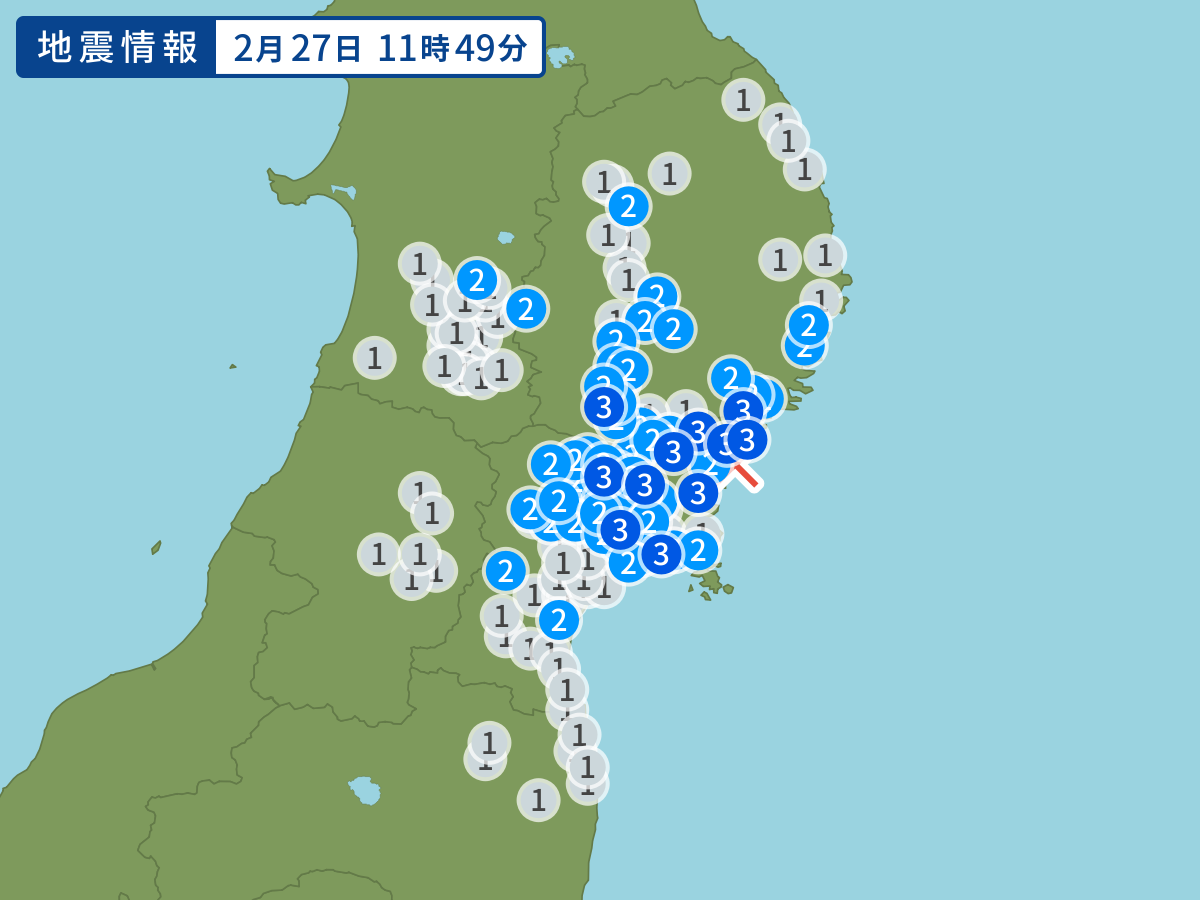
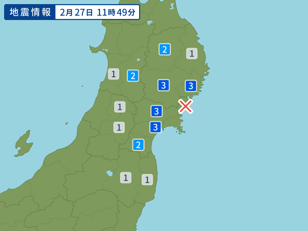
Occurred at 02/27/2004 11:49 JST
-
- Occurred at
- 02/27/2004 11:49
-
- Epicenter region
- Off the Coast of Miyagi Prefecture
-
- Maximum seismic intensity
- 3
-
- Magnitude
- 4.6
-
- Depth
- 70km
-
- Latitude/Longitude
- 38.8N141.6E
Seismic intensity in each area
Seismic intensity/Region where observed
| 3 |
|
|---|---|
| 2 |
|
| 1 |
|
02/27 11:49
Issued by the Japan Meteorological Agency (JMA)
Earthquake history
-
- Occurred at
- 04/28/2024 04:04
- Epicenter region
- Adjacent Sea of Miyakojima Island
- Maximum seismic intensity
- 2
- Magnitude
- 4.3
-
- Occurred at
- 04/27/2024 17:36
- Epicenter region
- Off the west Coast of Ogasawara Islands
- Maximum seismic intensity
- 3
- Magnitude
- 6.9
-
- Occurred at
- 04/27/2024 17:11
- Epicenter region
- Off the east Coast of Chiba Prefecture
- Maximum seismic intensity
- 2
- Magnitude
- 3.2
-
- Occurred at
- 04/27/2024 16:58
- Epicenter region
- Noto, Ishikawa Prefecture
- Maximum seismic intensity
- 1
- Magnitude
- 3.1
-
- Occurred at
- 04/27/2024 06:36
- Epicenter region
- Off the Coast of Iwate Prefecture
- Maximum seismic intensity
- 1
- Magnitude
- 3.6