Earthquake information
- Epicenter
- Epicenter
- Seismic intensity
-
- 1
- 2
- 3
- 4
- 5-
- 5+
- 6-
- 6+
- 7
- Epicenter
- Epicenter
- Seismic intensity
-
- 1
- 2
- 3
- 4
- 5-
- 5+
- 6-
- 6+
- 7
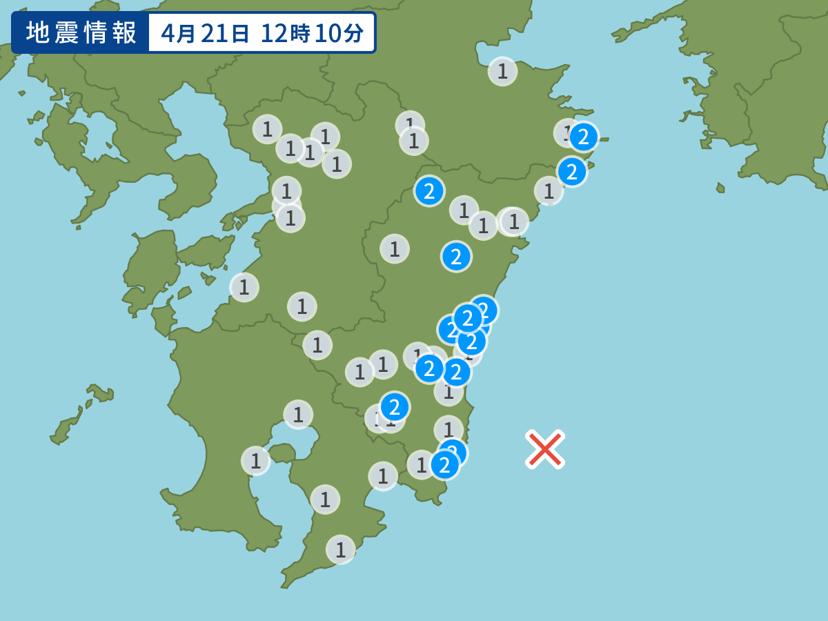
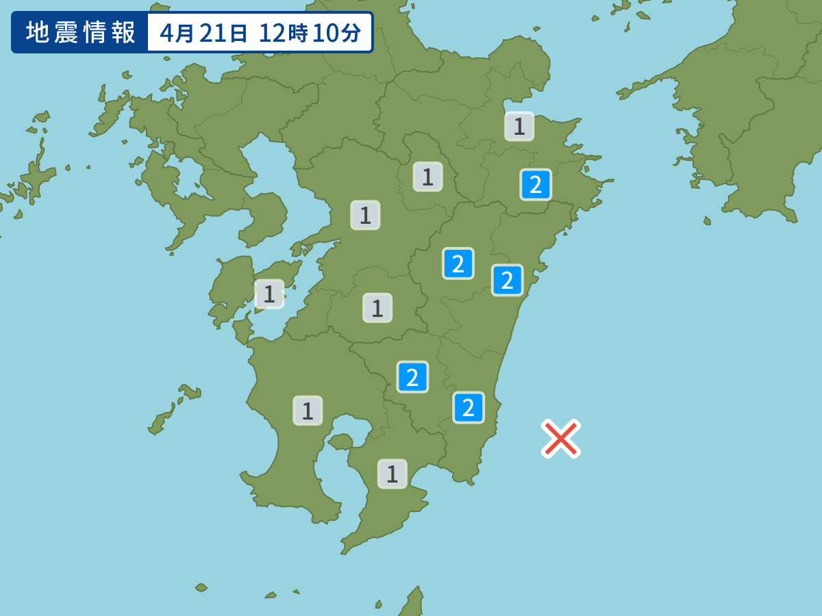
Occurred at 04/21/2004 12:10 JST
-
- Occurred at
- 04/21/2004 12:10
-
- Epicenter region
- Hyuganada Sea
-
- Maximum seismic intensity
- 2
-
- Magnitude
- 4.7
-
- Depth
- 25km
-
- Latitude/Longitude
- 31.6N131.8E
Seismic intensity in each area
Seismic intensity/Region where observed
| 2 |
|
|---|---|
| 1 |
|
04/21 12:10
Issued by the Japan Meteorological Agency (JMA)
Earthquake history
-
- Occurred at
- 04/27/2024 06:36
- Epicenter region
- Off the Coast of Iwate Prefecture
- Maximum seismic intensity
- 1
- Magnitude
- 3.6
-
- Occurred at
- 04/27/2024 06:10
- Epicenter region
- Adjacent Sea of Amami-Oshima Island
- Maximum seismic intensity
- 3
- Magnitude
- 4.0
-
- Occurred at
- 04/27/2024 03:21
- Epicenter region
- the vicinity of Taiwan
- Maximum seismic intensity
- 1
- Magnitude
- 5.8
-
- Occurred at
- 04/26/2024 21:58
- Epicenter region
- Kiisuido Strait
- Maximum seismic intensity
- 1
- Magnitude
- 2.3
-
- Occurred at
- 04/26/2024 18:34
- Epicenter region
- Noto, Ishikawa Prefecture
- Maximum seismic intensity
- 3
- Magnitude
- 2.5