Earthquake information
- Epicenter
- Epicenter
- Seismic intensity
-
- 1
- 2
- 3
- 4
- 5-
- 5+
- 6-
- 6+
- 7
- Epicenter
- Epicenter
- Seismic intensity
-
- 1
- 2
- 3
- 4
- 5-
- 5+
- 6-
- 6+
- 7
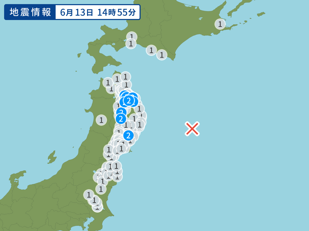
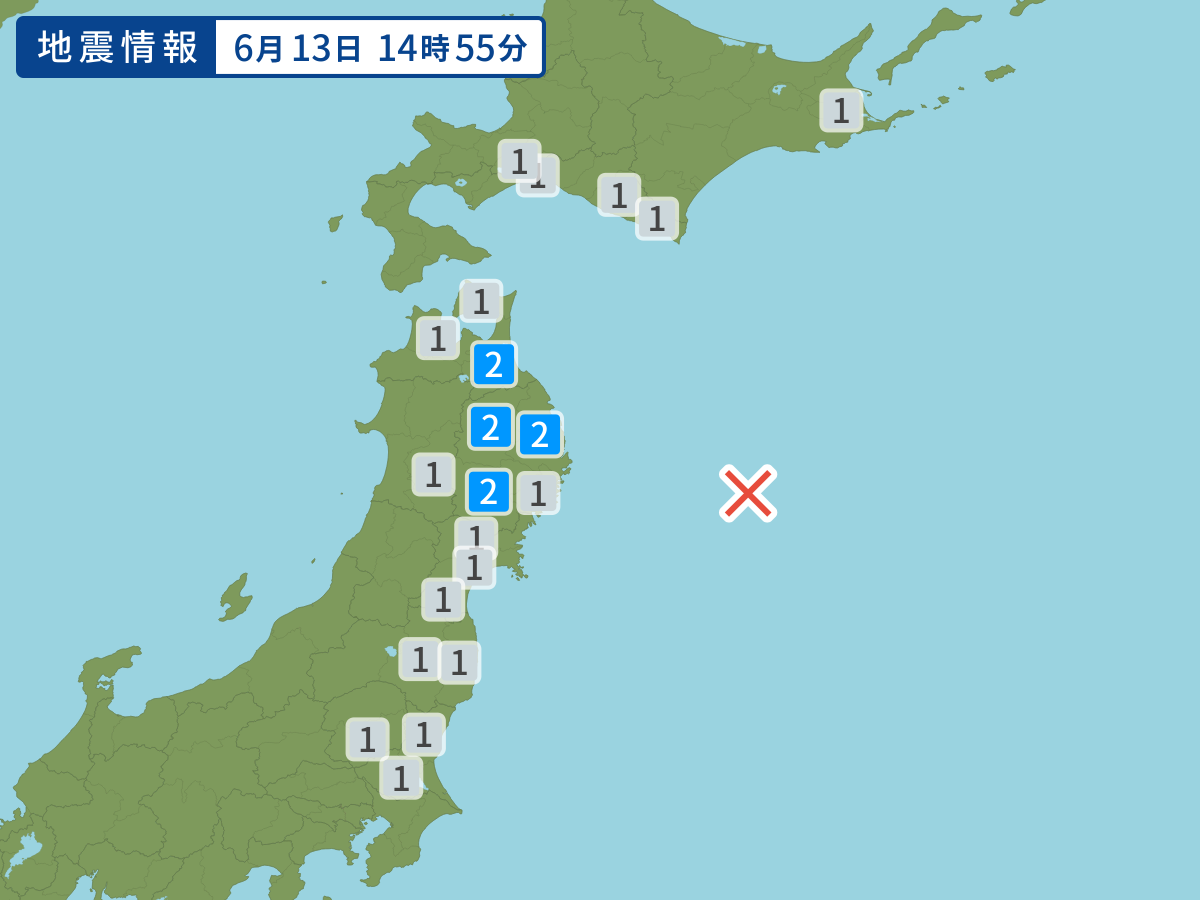
Occurred at 06/13/2004 14:55 JST
-
- Occurred at
- 06/13/2004 14:55
-
- Epicenter region
- Off the Coast of Sanriku
-
- Maximum seismic intensity
- 2
-
- Magnitude
- 5.3
-
- Depth
- Very shallow
-
- Latitude/Longitude
- 39.2N144.0E
Seismic intensity in each area
Seismic intensity/Region where observed
| 2 |
|
|---|---|
| 1 |
|
06/13 14:55
Issued by the Japan Meteorological Agency (JMA)
Earthquake history
-
- Occurred at
- 05/03/2024 13:52
- Epicenter region
- Bungosuido Strait
- Maximum seismic intensity
- 2
- Magnitude
- 3.3
-
- Occurred at
- 05/03/2024 12:32
- Epicenter region
- Noto, Ishikawa Prefecture
- Maximum seismic intensity
- 1
- Magnitude
- 2.4
-
- Occurred at
- 05/03/2024 11:42
- Epicenter region
- Bungosuido Strait
- Maximum seismic intensity
- 1
- Magnitude
- 3.5
-
- Occurred at
- 05/03/2024 09:10
- Epicenter region
- Northern Wakayama Prefecture
- Maximum seismic intensity
- 2
- Magnitude
- 3.8
-
- Occurred at
- 05/03/2024 08:27
- Epicenter region
- Reihoku, Fukui Prefecture
- Maximum seismic intensity
- 1
- Magnitude
- 2.9