Earthquake information
- Epicenter
- Epicenter
- Seismic intensity
-
- 1
- 2
- 3
- 4
- 5-
- 5+
- 6-
- 6+
- 7
- Epicenter
- Epicenter
- Seismic intensity
-
- 1
- 2
- 3
- 4
- 5-
- 5+
- 6-
- 6+
- 7
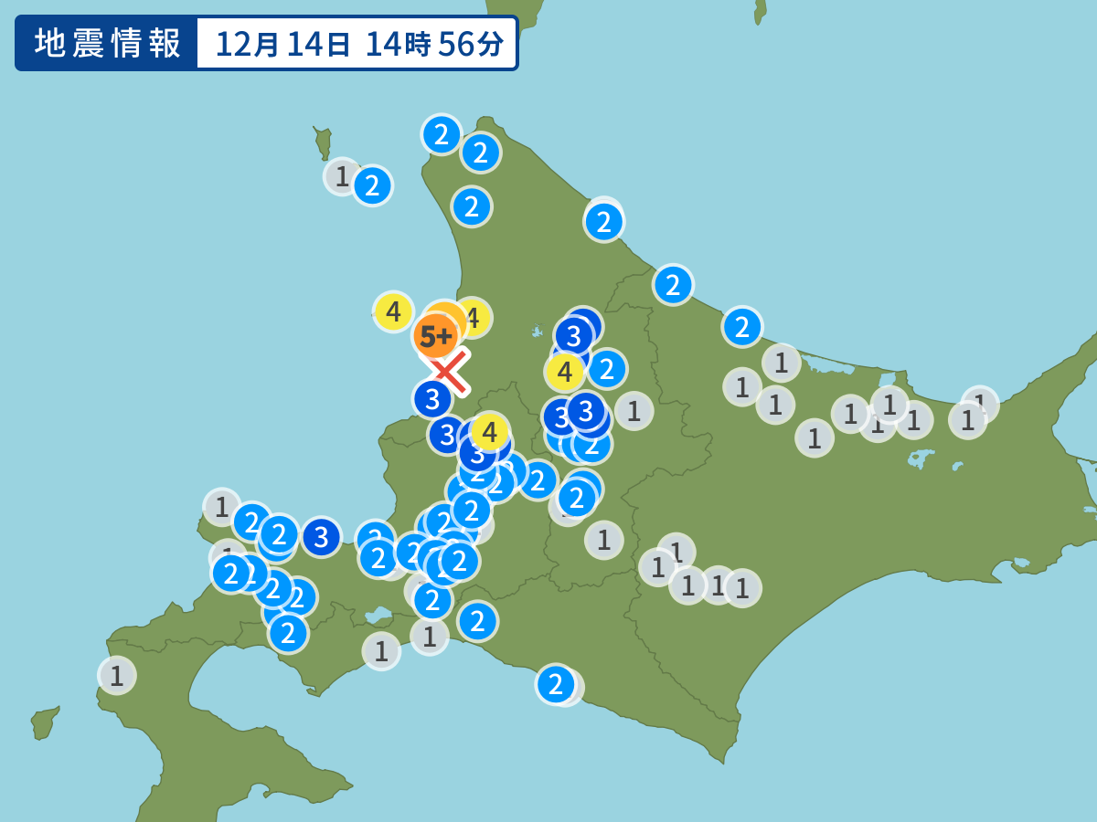
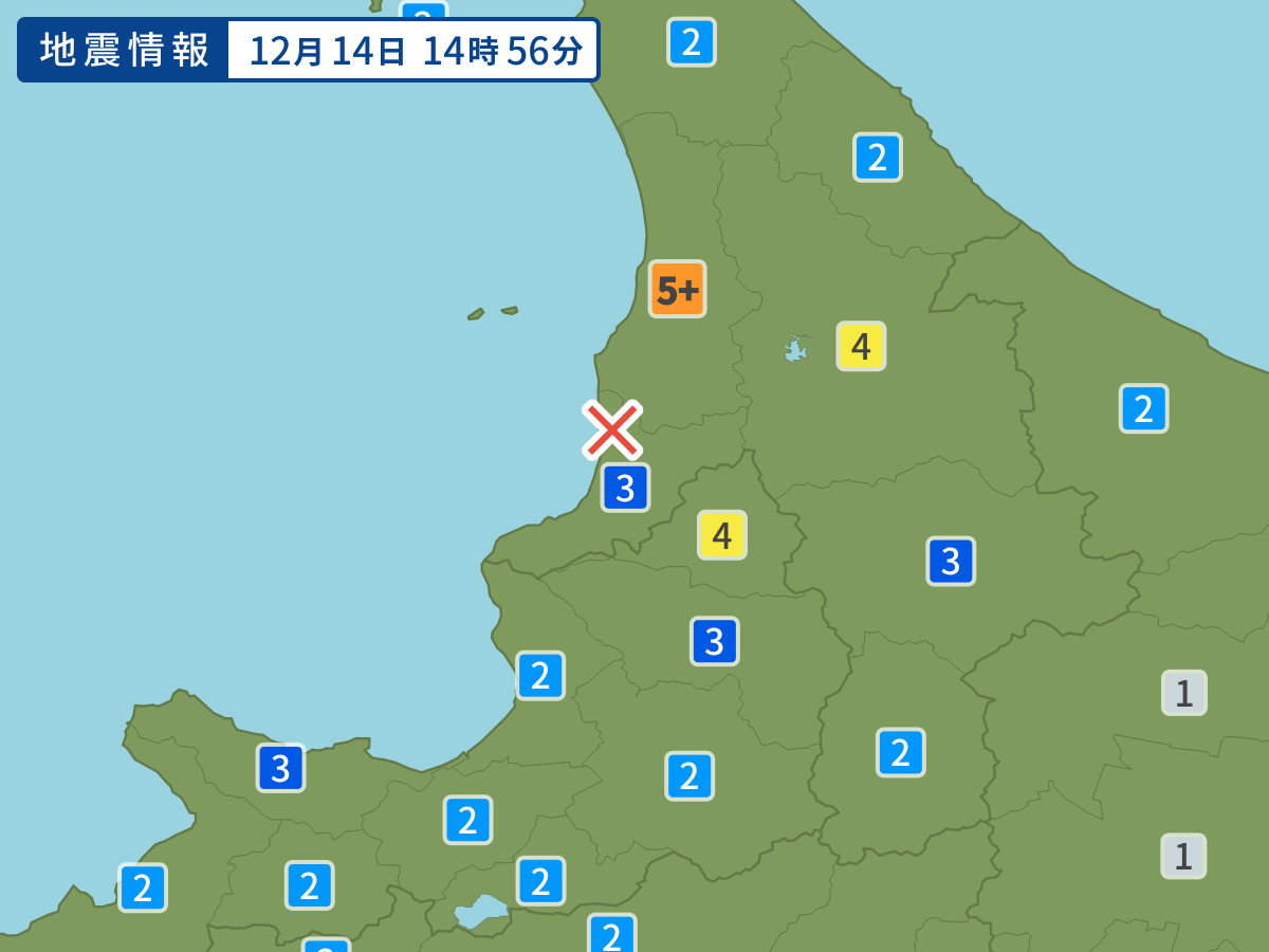
Occurred at 12/14/2004 14:56 JST
-
- Occurred at
- 12/14/2004 14:56
-
- Epicenter region
- Southern Rumoi Region, Hokkaido
-
- Maximum seismic intensity
- 5+
-
- Magnitude
- 6.1
-
- Depth
- 8km
-
- Latitude/Longitude
- 44.1N141.7E
Seismic intensity in each area
Seismic intensity/Region where observed
| 5+ |
|
|---|---|
| 4 |
|
| 3 |
|
| 2 |
|
| 1 |
|
12/14 14:56
Issued by the Japan Meteorological Agency (JMA)
Earthquake history
-
- Occurred at
- 04/29/2024 01:16
- Epicenter region
- Off the Coast of Fukushima Prefecture
- Maximum seismic intensity
- 3
- Magnitude
- 4.6
-
- Occurred at
- 04/29/2024 00:18
- Epicenter region
- Off the Coast of Iwate Prefecture
- Maximum seismic intensity
- 1
- Magnitude
- 3.4
-
- Occurred at
- 04/28/2024 23:40
- Epicenter region
- Northern Tsugaru, Aomori Prefecture
- Maximum seismic intensity
- 1
- Magnitude
- 2.3
-
- Occurred at
- 04/28/2024 22:29
- Epicenter region
- Off the Coast of Kushiro
- Maximum seismic intensity
- 2
- Magnitude
- 3.6
-
- Occurred at
- 04/28/2024 18:28
- Epicenter region
- Adjacent Sado
- Maximum seismic intensity
- 1
- Magnitude
- 4.0