Earthquake information
- Epicenter
- Epicenter
- Seismic intensity
-
- 1
- 2
- 3
- 4
- 5-
- 5+
- 6-
- 6+
- 7
- Epicenter
- Epicenter
- Seismic intensity
-
- 1
- 2
- 3
- 4
- 5-
- 5+
- 6-
- 6+
- 7
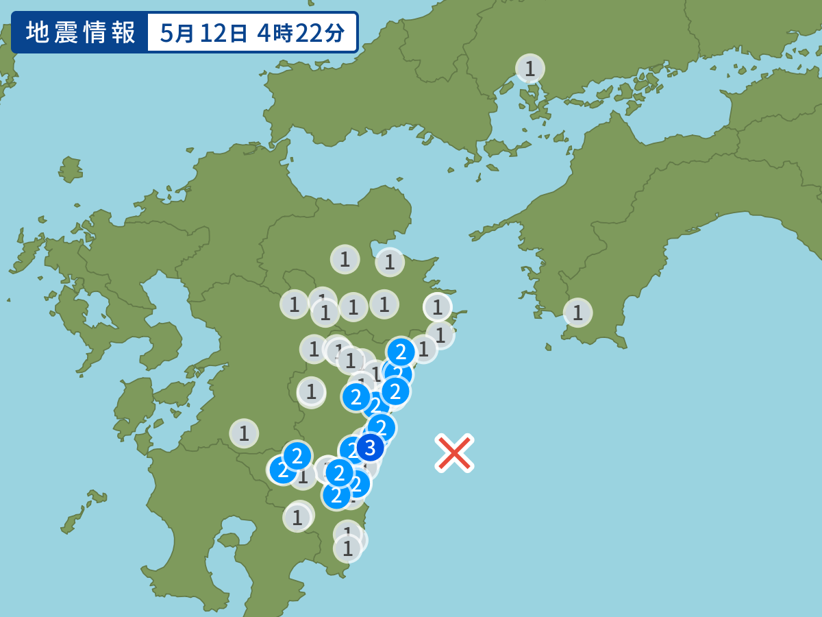
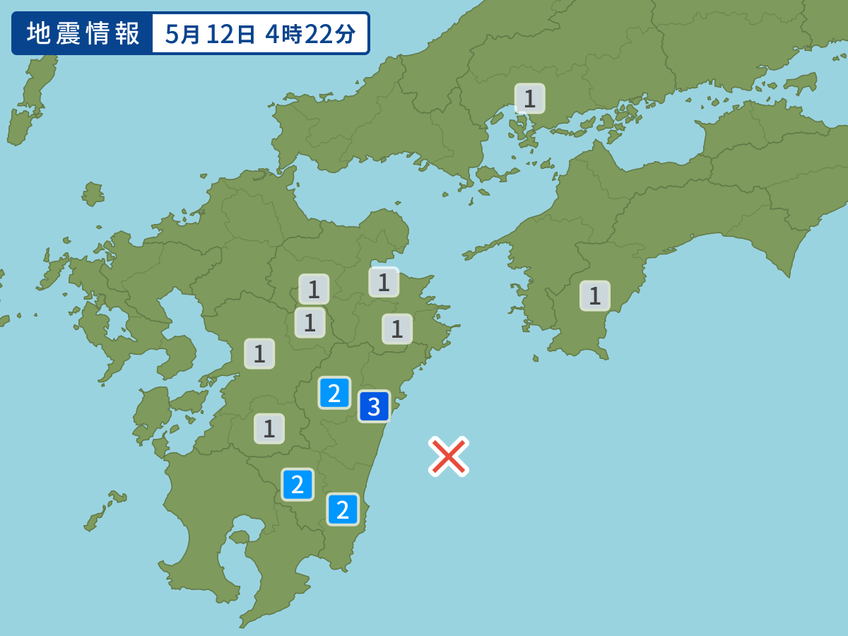
Occurred at 05/12/2005 04:22 JST
-
- Occurred at
- 05/12/2005 04:22
-
- Epicenter region
- Hyuganada Sea
-
- Maximum seismic intensity
- 3
-
- Magnitude
- 4.5
-
- Depth
- 29km
-
- Latitude/Longitude
- 32.1N132.0E
Seismic intensity in each area
Seismic intensity/Region where observed
| 3 |
|
|---|---|
| 2 |
|
| 1 |
|
05/12 04:22
Issued by the Japan Meteorological Agency (JMA)
Earthquake history
-
- Occurred at
- 04/28/2024 18:28
- Epicenter region
- Adjacent Sado
- Maximum seismic intensity
- 1
- Magnitude
- 4.0
-
- Occurred at
- 04/28/2024 14:38
- Epicenter region
- Noto, Ishikawa Prefecture
- Maximum seismic intensity
- 2
- Magnitude
- 3.1
-
- Occurred at
- 04/28/2024 11:38
- Epicenter region
- Off the southeast Coast of the Nemuro Peninsula
- Maximum seismic intensity
- 1
- Magnitude
- 3.4
-
- Occurred at
- 04/28/2024 09:26
- Epicenter region
- Off the Coast of Akita Prefecture
- Maximum seismic intensity
- 2
- Magnitude
- 4.6
-
- Occurred at
- 04/28/2024 04:04
- Epicenter region
- Adjacent Sea of Miyakojima Island
- Maximum seismic intensity
- 2
- Magnitude
- 4.3