Earthquake information
- Epicenter
- Epicenter
- Seismic intensity
-
- 1
- 2
- 3
- 4
- 5-
- 5+
- 6-
- 6+
- 7
- Epicenter
- Epicenter
- Seismic intensity
-
- 1
- 2
- 3
- 4
- 5-
- 5+
- 6-
- 6+
- 7
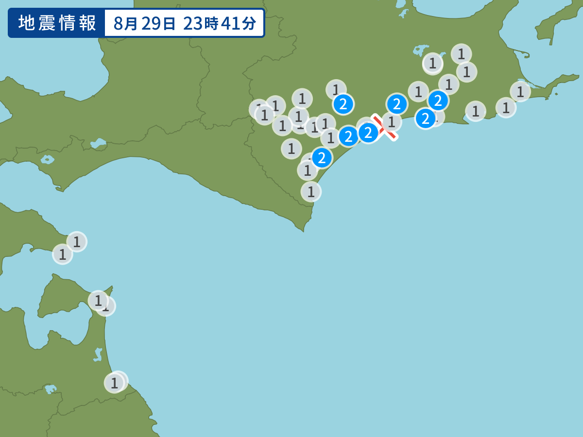
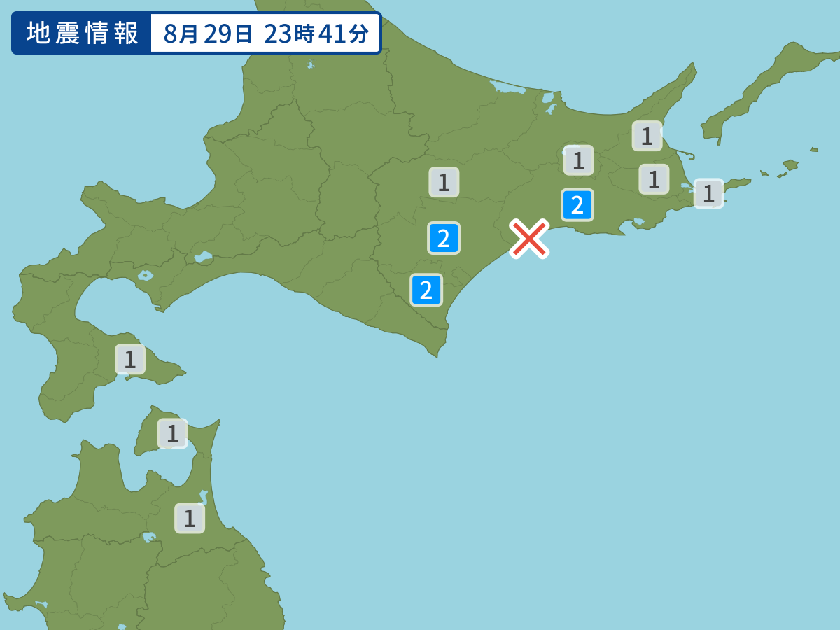
Occurred at 08/29/2008 23:41 JST
-
- Occurred at
- 08/29/2008 23:41
-
- Epicenter region
- Central and southern Kushiro Region, Hokkaido
-
- Maximum seismic intensity
- 2
-
- Magnitude
- 4.1
-
- Depth
- 96km
-
- Latitude/Longitude
- 42.9N144.0E
Seismic intensity in each area
Seismic intensity/Region where observed
| 2 |
|
|---|---|
| 1 |
|
08/29 23:41
Issued by the Japan Meteorological Agency (JMA)
Earthquake history
-
- Occurred at
- 05/02/2024 04:06
- Epicenter region
- Off the Coast of Miyagi Prefecture
- Maximum seismic intensity
- 1
- Magnitude
- 3.6
-
- Occurred at
- 05/02/2024 02:37
- Epicenter region
- Adjacent Sea of Tanegashima Island
- Maximum seismic intensity
- 2
- Magnitude
- 3.3
-
- Occurred at
- 05/02/2024 02:36
- Epicenter region
- Off the Coast of Fukushima Prefecture
- Maximum seismic intensity
- 1
- Magnitude
- 3.9
-
- Occurred at
- 05/02/2024 02:27
- Epicenter region
- Hida, Gifu Prefecture
- Maximum seismic intensity
- 1
- Magnitude
- 2.6
-
- Occurred at
- 05/01/2024 21:54
- Epicenter region
- Noto, Ishikawa Prefecture
- Maximum seismic intensity
- 2
- Magnitude
- 2.8