Earthquake information
- Epicenter
- Epicenter
- Seismic intensity
-
- 1
- 2
- 3
- 4
- 5-
- 5+
- 6-
- 6+
- 7
- Epicenter
- Epicenter
- Seismic intensity
-
- 1
- 2
- 3
- 4
- 5-
- 5+
- 6-
- 6+
- 7
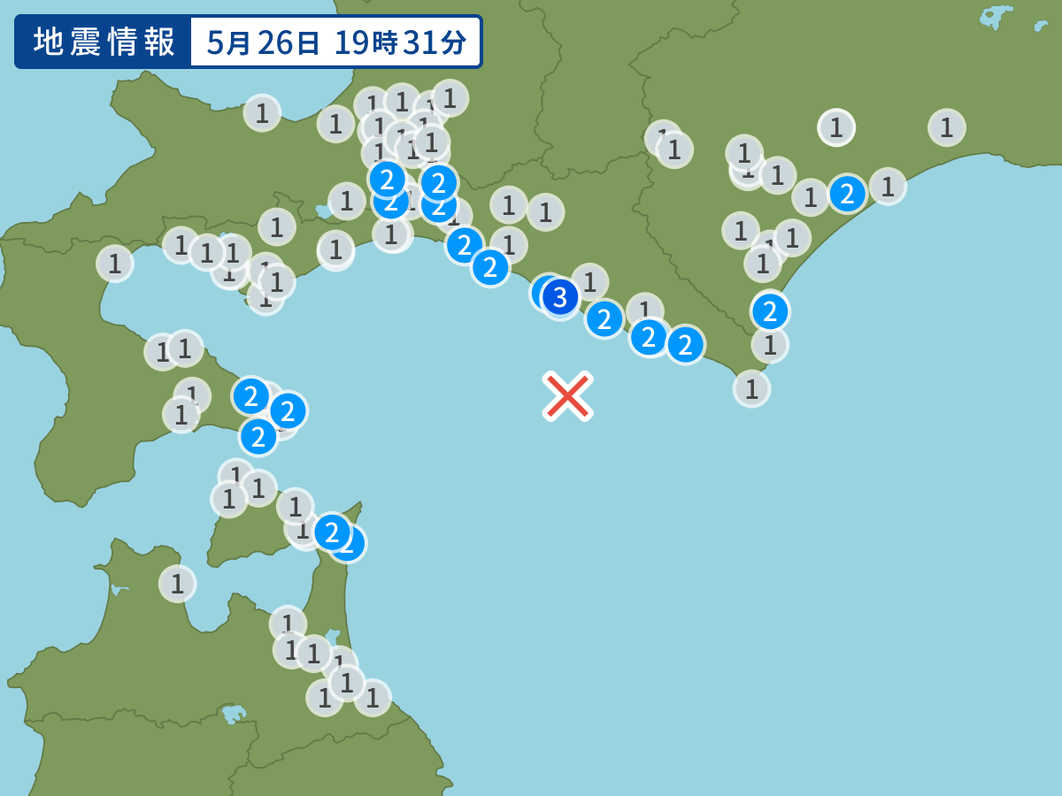
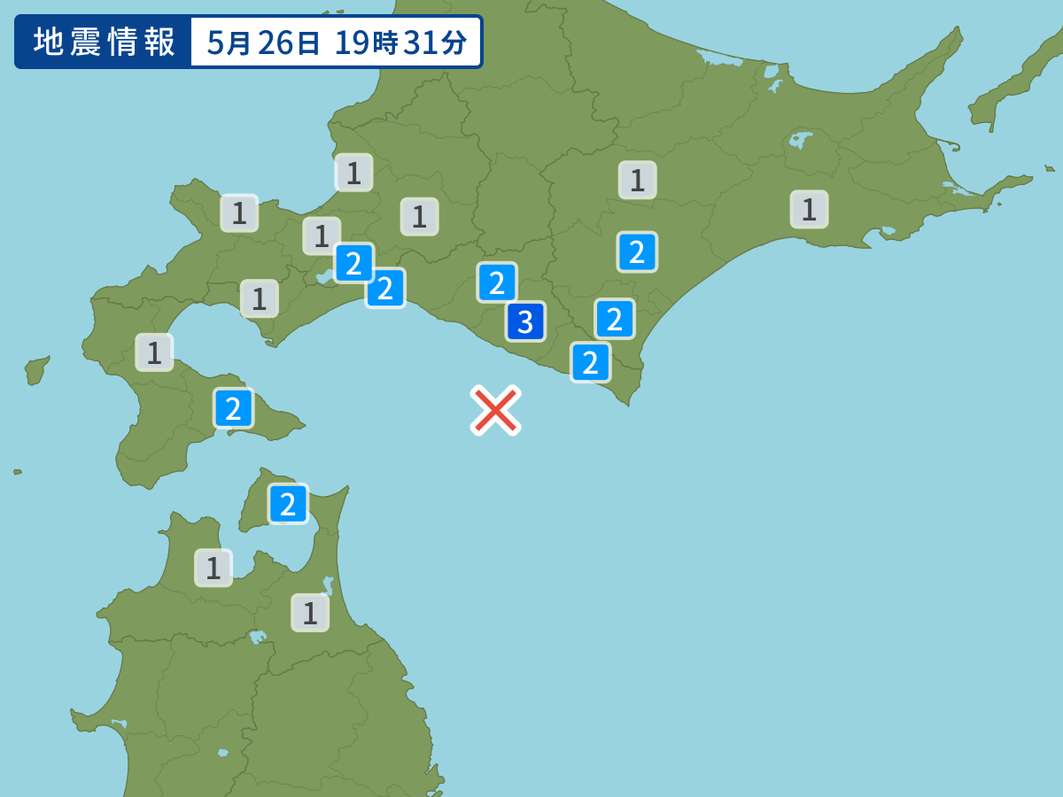
Occurred at 05/26/2009 19:31 JST
-
- Occurred at
- 05/26/2009 19:31
-
- Epicenter region
- Off the Coast of Urakawa
-
- Maximum seismic intensity
- 3
-
- Magnitude
- 4.7
-
- Depth
- 69km
-
- Latitude/Longitude
- 41.9N142.4E
Seismic intensity in each area
Seismic intensity/Region where observed
| 3 |
|
|---|---|
| 2 |
|
| 1 |
|
05/26 19:31
Issued by the Japan Meteorological Agency (JMA)
Earthquake history
-
- Occurred at
- 05/06/2024 03:53
- Epicenter region
- Noto, Ishikawa Prefecture
- Maximum seismic intensity
- 2
- Magnitude
- 3.3
-
- Occurred at
- 05/06/2024 00:50
- Epicenter region
- Bungosuido Strait
- Maximum seismic intensity
- 3
- Magnitude
- 3.9
-
- Occurred at
- 05/05/2024 14:52
- Epicenter region
- Southern Kyoto Prefecture
- Maximum seismic intensity
- 1
- Magnitude
- 3.0
-
- Occurred at
- 05/05/2024 14:47
- Epicenter region
- Adjacent Sea of Tokara Islands
- Maximum seismic intensity
- 1
- Magnitude
- 1.7
-
- Occurred at
- 05/05/2024 06:54
- Epicenter region
- Off the Coast of Iwate Prefecture
- Maximum seismic intensity
- 1
- Magnitude
- 3.4